
MSPO 2026 – Hanwha unveils it’s AI-enabled EO/ISAR satellite intelligence solution
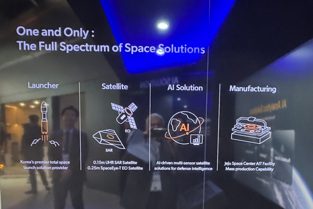
Hanwha unveiled an artificial-intelligence-enabled space solution at MSPO 2026, designed to automate the exploitation of Earth-observation data and accelerate its delivery to military command structures. The South Korean defence and advanced-space company presented its Space AI Solution as the first publicly unveiled platform capable of integrating electro-optical (EO) and synthetic-aperture radar (SAR) satellite imagery within a single AI-driven analytical environment
The system is designed to convert raw satellite imagery into actionable intelligence in near real time. Its operational chain extends from the reception of imagery collected by an in-orbit satellite through to automated object detection, anomaly identification, report generation and the distribution of alerts to command-and-control (C2) systems, deployed formations and relevant organisations.
A Multi-Sensor Intelligence Architecture
The solution combines two complementary types of space-based imagery. Each provides a distinct form of observation and, when exploited together, can offer a more resilient and detailed intelligence picture.
| Imagery type | Technical principle | Operational contribution |
| EO — Electro-optical | Captures reflected light in the visible spectrum and, depending on the payload, near-infrared bands | Visual identification of infrastructure, vehicles, aircraft, vessels, positions, activity patterns and changes on the ground |
| SAR — Synthetic-aperture radar | Transmits radar energy and processes returned echoes to create high-resolution imagery | Day-and-night, all-weather observation; change detection; surface analysis; movement monitoring; and imaging through cloud cover |
The value of the system lies not merely in providing access to several sources of imagery, but in their combined exploitation. An anomaly first detected in SAR imagery, for example, may be correlated with EO data when weather and illumination conditions allow, then supplemented with infrared information to establish whether it is linked to thermal activity.

This cross-cueing approach can reduce the uncertainty associated with individual sensors. A vehicle that is difficult to identify in optical imagery may exhibit a recognisable radar signature; an area showing unusual activity may be highlighted through infrared data; and a change detected in SAR imagery may be visually characterised through EO collection.
AI at the centre of exploitation
According to Hanwha, the solution automatically analyses satellite imagery in order to identify objects and detect anomalies. From a product perspective, this involves several layers of processing.
First, imagery is prepared for analysis through data ingestion, geo-referencing, geometric correction, normalisation and alignment of products received from different sensors. EO, and SAR imagery result from different physical phenomena and possess different visual and analytical characteristics. To compare or combine them effectively, they must be tied to a common geographical and temporal reference framework.
The next stage involves AI-enabled analysis. Algorithms are used to search for objects of interest – including vehicles, vessels, buildings, infrastructure, airfields, logistics assets and other identifiable features – and distinguish them from the background. They can also support change detection between successive collections, highlighting the arrival of a new object, the relocation of vehicles, a modified site layout, activity around an installation or developments in a maritime area.
The anomaly-detection function is particularly significant. It alerts operators or C2 systems to an item that departs from an expected pattern, configuration or signature. Rather than requiring analysts to inspect every image manually, the system can prioritise the most relevant collections and focus human attention on potentially significant developments.
From orbital data to C2 networks
Hanwha designed its solution to transfer analysis results rapidly to command-and-control networks, field units and relevant organisations. This is a critical aspect of the concept: high-performance image analysis offers limited operational benefit if the resulting intelligence cannot reach decision-makers and users quickly enough.

In practice, the system serves as a bridge between space-based collection assets and the decision-making cycle. It can generate structured information for insertion into a common operational picture, including the geographic position of a detected object or anomaly, it’s probable classification, the time of collection, the confidence level attributed by the algorithm, observed changes and an alert priority.
Automated situation-report generation represents the second major feature of the offering. Drawing on the analytical results, the AI produces real-time summaries intended to enable users to understand complex developments rapidly. Such reports may combine annotated imagery, geospatial coordinates, a description of the observed event and a comparison with earlier collections.
The objective is to shorten the traditional intelligence cycle: Satellite collection→Processing→Analysis→Validation→C2 dissemination→Decision
By automating a significant proportion of the processing and analytical workload, Hanwha aims to reduce the interval between image capture and the delivery of intelligence that commanders can use.
Live demonstration with an operational satellite
At MSPO 2026, Hanwha demonstrated the solution through the analysis of real-time imagery of Eastern Europe collected by an operational satellite already in orbit. The presentation was based on real space-derived data rather than exclusively on archived datasets or simulated scenarios.
Visitors were able to observe the transformation of live satellite data into operationally relevant information: image reception, automated object or anomaly detection, AI-based interpretation and the production of an exploitable situation report. The demonstration illustrated how the system processes data in a real operating environment, where satellite observation is affected by weather, image quality, acquisition geometry, transmission delay and the diversity of signatures present on the ground.
Hanwha has not disclosed the resolution of the sensors involved, the number of satellites supporting the demonstration, the precise latency between image acquisition and intelligence dissemination, or the degree of autonomy granted to the algorithm in the analytical and alerting process. These factors will be important in assessing the system’s operational maturity and its suitability for military users.
Meeting modern ISR requirements
Hanwha’s Space AI Solution reflects the evolution of intelligence, surveillance and reconnaissance (ISR) towards more distributed, connected and automated architectures. The expanding number of Earth-observation satellites and the volume of imagery they produce have created a challenge increasingly centred not on collection itself, but on the rapid, reliable and prioritised exploitation of the resulting data.
The integration of EO and SAR imagery within a common AI-enabled workflow is intended to address that challenge. It can enhance surveillance persistence, sustain observation during darkness or cloud cover, and provide analysts with a richer understanding of a particular area of interest.
For armed forces, such a capability can support border surveillance, monitoring of military movements, observation of operational areas, protection of critical infrastructure, maritime intelligence, battle-damage assessment, monitoring of logistics routes and detection of unusual activity around sensitive sites.
At Kielce, Hanwha demonstrated that space-derived data can feed directly into tactical and operational decision-making. Its proposition is one of faster, better-correlated and more accessible intelligence: not simply images received from orbit, but geo-located, analysed and prioritised information ready for integration into the operational picture.
Photos by J. Roukoz


