FIA2024 – Software Enhanced Navigation by Flare Bright
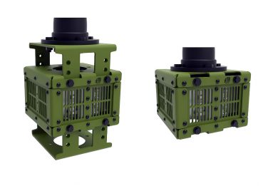
Amongst the hundreds of SMEs vying for attention and recognition at FIA2024 was Flare Bright Ltd, a UK-based company highlighting its Software Enhanced Navigation System, which implemented onto a US$5 Inertial Measurement Unit chip, is comparable to that of a tactical and navigational grade Inertial Navigation System
Following initial funding from the Defence And Security Accelerator (DASA), Flare Bright has won contracts from leading aerospace companies, the UK Ministry of Defence and the United States Department of Defense.
Flare Bright’s GPS-free navigation software cannot be spoofed by an adversary, as happens regularly to drones in the Ukraine conflict. The successful one hour endurance flight trials over land and sea were to prove that the software contained in the drone could continuously determine speed and position taking into account data and signals of opportunity, which are not commonly used for navigation. This unique software gave the drone constant, highly accurate internal navigation ‘fixes’ on its location. As it does not require camera-based navigation, which cannot work over water or other featureless terrain, it is reliable enough for operational use.
The software uses these onboard signals and data as well as an onboard digital twin software, with its extremely accurate representations of all the aircraft’s performance data and parameters. Flare Bright makes best use of the data and signals by modelling the drone, breaking it down into many small digital pieces to create a physics model used to make testable predictions about its behaviour. Combining all these systems provides a robust GPS-free navigation capability without adding extra hardware or sensors, giving the quality of a high performance navigation sensor by combining a low cost navigation sensor with Flare Bright’s software.
Currently, Flare Bright is engaged on its fourth sprint project with the US Department of Defense, conducting a series of trials of its technology in Spain, over water, so no visual navigation, and without GPS using a Spanish 2 metres wingspan CATUAV drone.
The software enhanced navigation system has no camera, no communications and more importantly, no GPS. It enables any platform to operate in any weather or terrain, in both day and night conditions. The company has also been asked to use its machine learning digital twin expertise in both the maritime and subsea sector and for other optimisation tasks for a wide range of technologies.
Photo courtesy Flare Bright


