NavGuard: overcoming navigation issues in GNSS-denied conditions
By Paolo Valpolini
Based in Rosh Ha’ayin, a few kilometres west of Tel Aviv, Asio Technologies is specialised in geo-spatial position acquisition systems encompassing navigation, positioning, mission planning, mission management and system integration.
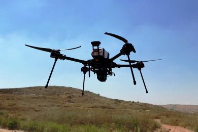
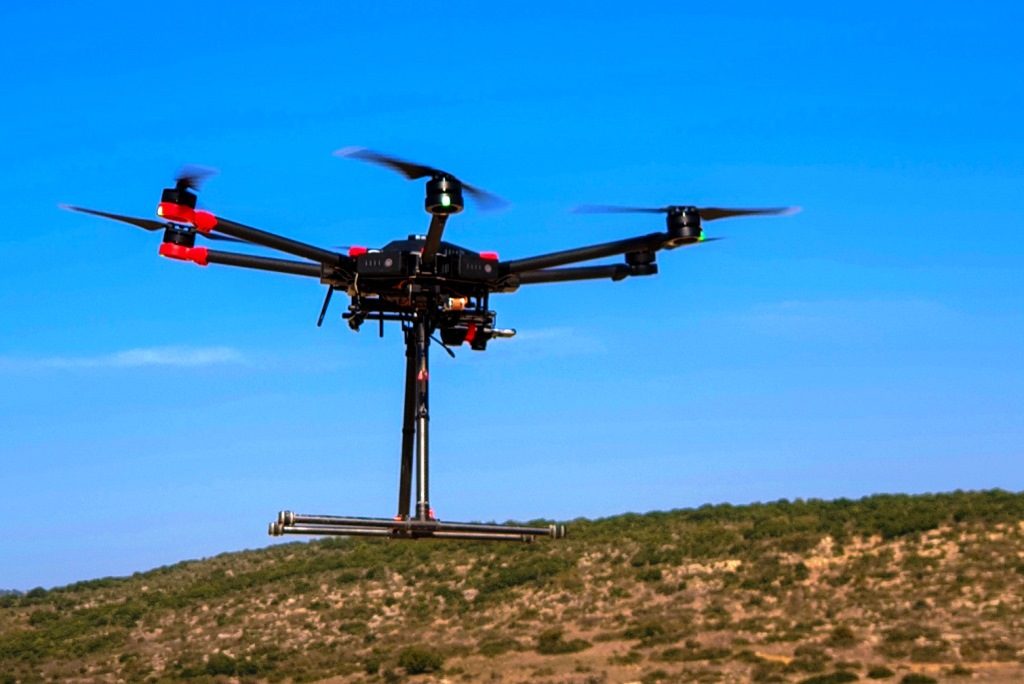
Among its many products the company offers NavGuard, a navigation system for UAS that allow them to fly in GPS-denied conditions
The system was publicly tested some months ago, but details have just been unveiled. Instead of having a system that exploits a GNSS signal as long as it is available, transitioning to a Simultaneous Localization And Mapping (SLAM) or to an Inertial Navigation System (INS) when the satellite signal becomes unavailable or unreliable, Asio Technologies decided to go for a system that does not consider GNSS since inception. Known with the acronym GRONS (Geo-Referencing Optical Navigation System), it exploits a geo-referenced ortophoto of the operational area; large area orthophotos can be saved on the system’s internal storage, the NavGuard requiring a standard accuracy/resolution image for navigation grade solution, lower resolution maps being used for higher altitudes navigation.

The system comes integrated with a dedicated down-looking camera that generates low latency images of the area overflown by the UAS, and this is matched to the referenced ortophoto; as an extension feature is can also utilize the UAV electro-optical payload. According to Asio Technologies, the system has a slightly higher latency than a standard GNSS based system. As the ortophoto pixels contain their own grid data, by comparison the UAS that flies over those pixels knows its position with utmost accuracy. Compared to inertial systems the GRONS technology does not suffer any drift. It can however be limited by bad visibility conditions. “The system must have a view of the ground, so clouds and smoke would impair performance, however even partial view can generate constant and correct position, depending on the availability of ground-based features,” Asio Technologies told EDR On-Line. As for navigating at night, “were there are peripheral lighting, such streetlights, highways lights, etc, a light sensitive CMOS is sufficient for constant navigation” the company stated.
According to Asio, a UAS fitted with the NavGuard can fly at an altitude above ground between 70 and 500 meters configurable, with a maximum speed of 18 m/s (65 km/h). Asio Technologies explains that NavGuard’s optical array gives a band of operational heights (minimum to maximum), but it can also be configured optically to spec to meet specific altitudes.
When integrated into a UAS the NavGuard, which is powered with 14 V or 36 V DC, has a weight of less than 100 grams. A podded version is however available to add it externally to existing UAS, in that case weight increasing to 280 grams. The interface with the UAS flight control system is provided either via a GNSS like channel or through a dedicated interface control document via LAN or serial port. The NavGuard is fully developed and available to the market.
Photos courtesy Asio Technologies